Stuðlagil Canyon: the Basalt Gorge That Appeared in 2009
Studlagil Canyon, written Stuðlagil in Icelandic, is a gorge of basalt columns in the Jökuldalur valley of East Iceland, and until about twenty years ago nobody had seen the bottom of it. A hydro dam took most of the river away, the water dropped, and one of the largest columnar basalt formations in the country came into view. This page covers both sides of the canyon, what each walk costs you in time and money, when the river is turquoise, and the Seydisfjordur tours that drive there from the cruise pier.
Quick answer
Stuðlagil is a basalt canyon on the Jökulsá á Dal, about an hour from Egilsstaðir on road 923 and 98.8 km from the Seyðisfjörður cruise pier. Two sides give two different visits: the west side is 245 metal steps down to a viewing platform, 15 minutes on your feet; the east side is a 5.7 km round trip on a flat track that puts you among the columns at river level. Both are free to enter, though east-side parking costs 1,000 ISK. Guided trips from the pier run $227 to $407.
Key takeaways
- West side: park at the farm Grund, walk 0.6 km and 245 steps, paid toilets and covered seating at the car park
- East side: from near Klaustursel, 5.7 km round trip with 130 m of climbing, about an hour of walking, no facilities at all
- Parking on the east side is 1,000 ISK per vehicle through the Parka app; the west car park is free to use
- The river runs turquoise from roughly March to July and turns grey as summer meltwater increases
- Season is June to October. In winter the tracks ice over and most operators stop
- From the cruise pier, guided trips cost $227 to $407 and take five to seven hours
A Canyon That a Power Station Uncovered
What you are looking at
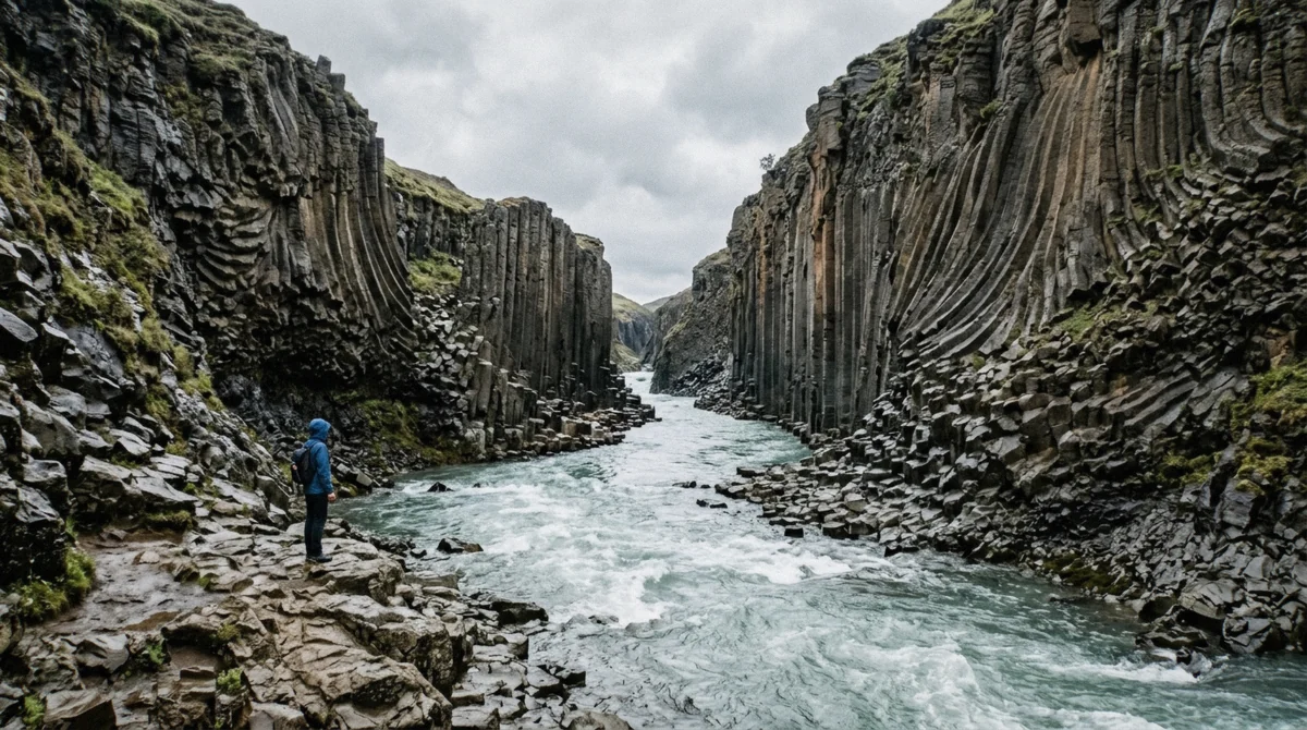
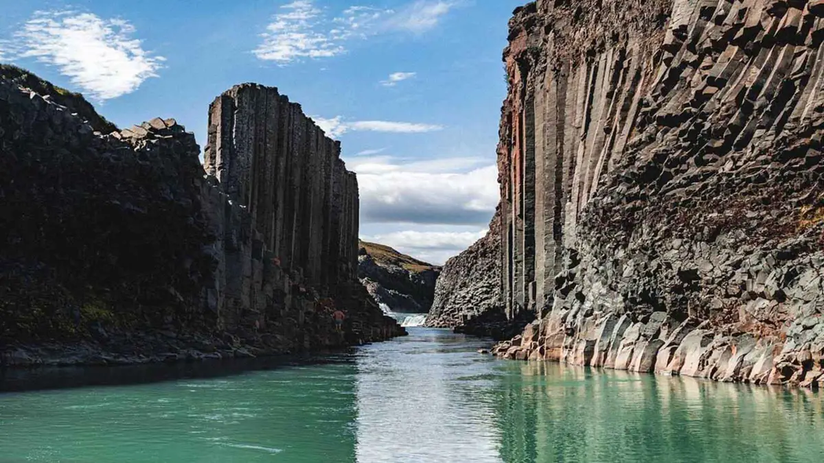
The walls are columnar basalt: lava that cooled slowly enough to crack into columns as it contracted. The textbook version is hexagonal, and plenty of these are, but a good number have four, five or seven sides, and whole sections curve and fan rather than standing straight. The tallest walls reach around 30 m.
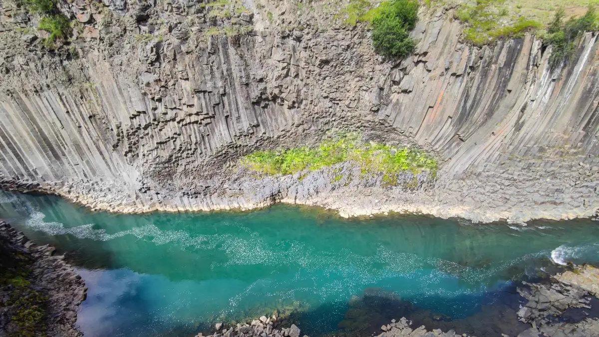
The river underneath is the Jökulsá á Dal, glacier-fed, and its colour comes from fine rock flour held in suspension. When the flow is low and the sediment load is light, that flour scatters light into the pale blue-green that put the place on every Iceland itinerary.
Why nobody photographed it before 2009
The Kárahnjúkar hydro scheme was completed in 2009. It dams the Jökulsá á Dal at the head of the valley to fill the Hálslón reservoir and diverts the water through tunnels to a power station that supplies an aluminium smelter at Reyðarfjörður. The effect downstream was to cut the river from roughly 205 m³/s to roughly 95 m³/s.
Between 2006 and 2009, as the level dropped by seven to eight metres, the columns came out of the water. Farmers in Jökuldalur had always known there was rock down there. What nobody had seen was the scale of it.
How it became famous
The Icelandic photographer and travel writer Einar Páll Svavarsson published the pictures that did it in 2016. Within two years the country's tourism minister was naming the canyon in speeches, and by 2019 the University of Iceland and the Icelandic Tourism Research Centre had it in a report as a genuine new destination.
That is fast, even by Iceland's standards. It also explains why the infrastructure feels improvised: the footpaths, the car parks and the staircase were all built after the crowds arrived, and a footbridge across the river has been planned since 2019 without yet being built.
The part the postcards leave out
The same project that revealed Stuðlagil drowned a large piece of highland wilderness behind the dam, including Töfrafoss, a waterfall that now sits under the Hálslón reservoir for most of the year. Kárahnjúkar was the most contested construction project in modern Icelandic history and the arguments about it have not gone quiet.
Call Stuðlagil an accident of conservation and you have it about right: a landscape that exists as a sight because another one was flooded. Guides on the drive up tend to tell you this. It is worth hearing before you decide the turquoise water is natural, because the shade you are photographing is a by-product of a power station.
How you say it
Stuðlagil breaks into stuðla, meaning columns, and gil, meaning gorge. Roughly: STUTH-la-gil, with the ð sounded like the th in that rather than a hard d, and the g soft. Nobody local will mind if you miss it.
The farms in the valley have been listening to visitors try for a decade.
West Side, East Side, or a Guided Trip
Three ways to see the same gorge. The differences are real and most people pick the wrong one for their day.
| Way in | Walking | Time on foot | Book | Cost | Suits |
|---|---|---|---|---|---|
| West side, Grund | 0.6 km and 245 steps | 15 to 30 minutes | Free, paid toilets | Short stops, mixed ability, bad weather | |
| East side, Klaustursel | 5.7 km round trip | About an hour walking | 1,000 ISK parking | Photographers, anyone who wants the classic view | |
| Guided from the pier, rim | A few hundred metres | Under an hour | $227 to $325 per person | Cruise calls without a car | |
| Guided from the pier, hike | 5 km round trip | About two hours | $369 to $407 per person | Cruise calls that want the canyon floor |
Guided Trips That Go to Stuðlagil
Everything below leaves from the Seyðisfjörður pier or the town. Prices and ratings from the operators' listings in July 2026.
from $227 Stuðlagil Canyon Shore Excursion From Seyðisfjörður
- West-side viewing platforms over Stuðlagil Canyon
- Basalt columns up to 30 m above the turquoise Jökla river
- 27-metre Gufufoss waterfall on the return leg
- Pickup and drop-off at the cruise terminal
 from $233
 Stuðlagil Canyon With Rjúkandi and Gufufoss Waterfalls
- Rjúkandi waterfall in Jökuldalur valley
- A full hour at Stuðlagil Canyon
- Gufufoss waterfall near town
- Meets tender arrivals at the cruise port
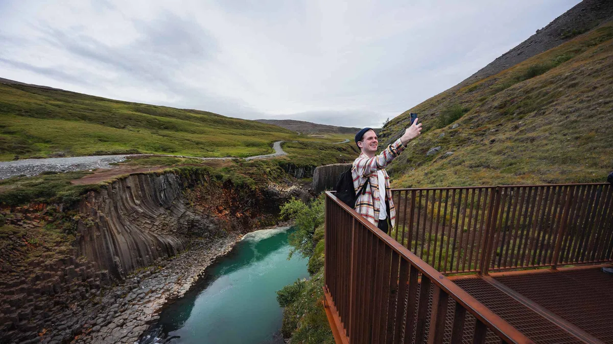 from $325
 Stuðlagil Viewpoints and Vök Baths Without the Hike
- West-side platforms, no canyon-floor hike
- Short accessible walking trails
- Vök Baths floating geothermal pools
- Rjúkandi waterfall and Jökuldalur valley
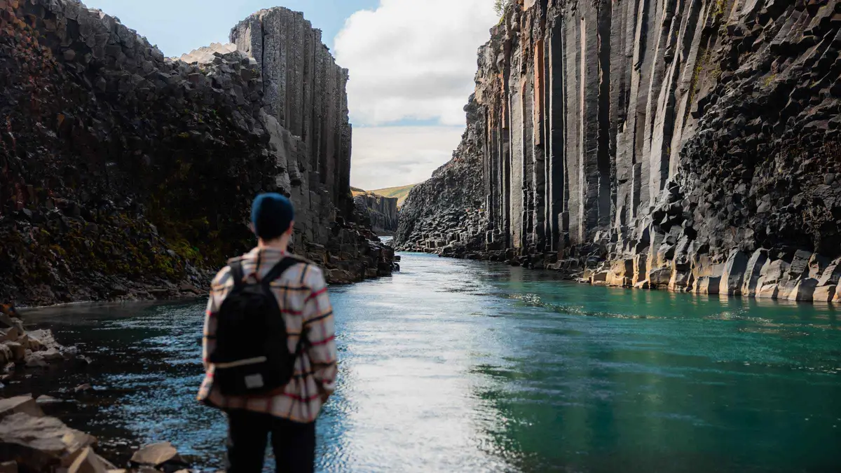 from $407
 Stuðlagil East-Side Hike Plus a Soak at Vök Baths
- 5 km round-trip hike to the canyon floor
- East-side basalt columns at river level
- Admission to Vök Baths included
- Minibus, small group, pickup at the pier
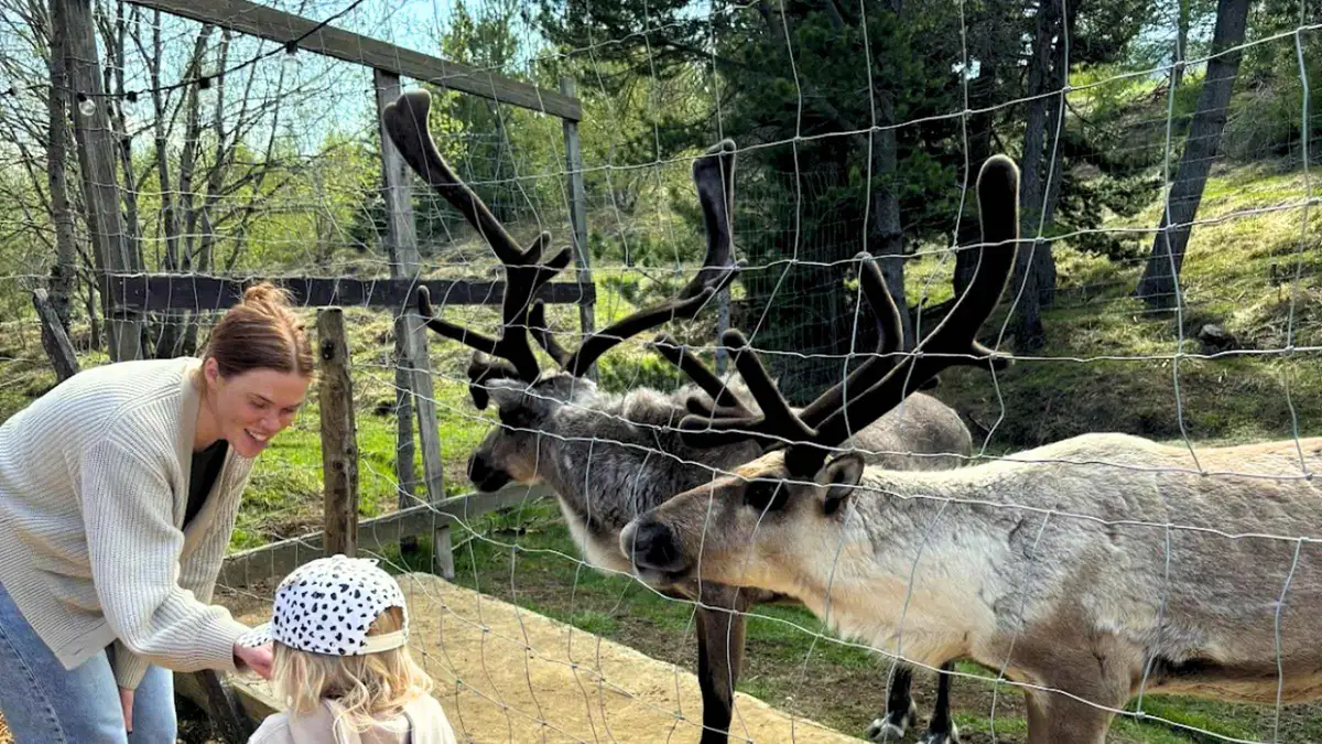 from $369
 Stuðlagil Canyon Hike and the Reindeer Park
- East-side canyon hike, 2.5 km each way
- Reindeer Park with rescued calves
- Rjúkandi waterfall stop
- Pickup in Seyðisfjörður or Egilsstaðir
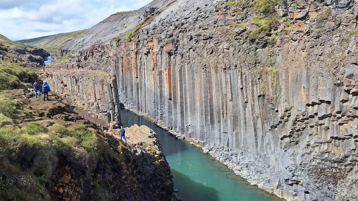 from $2,290 per group
 Private Jeep Day to Stuðlagil for up to Four
- Private jeep and guide, up to 4 people
- Flexible itinerary and timing
- Optional Vök Baths or Reindeer Park add-on
- Pickup in Seyðisfjörður, Egilsstaðir or Fellabær
Getting There and Walking In
The drive
Stuðlagil sits off road 923, which leaves the Ring Road in the Jökuldalur valley. From Egilsstaðir it is about an hour. From the Seyðisfjörður pier it is 98.8 km and around 90 minutes each way, which is the single fact that shapes every guided trip out of the fjord: 5 to 7 hours door to door, whatever the operator promises.
From Reykjavík it is a full day and then some, around 600 km by the south coast. Nobody sensible does it as a day trip; people either stay in Egilsstaðir or take it as part of a Ring Road run.
Road 923 itself is gravel in stretches but graded, and the two sides are seven minutes apart by car despite facing each other across the water. There is no bridge.
West side: the staircase at Grund
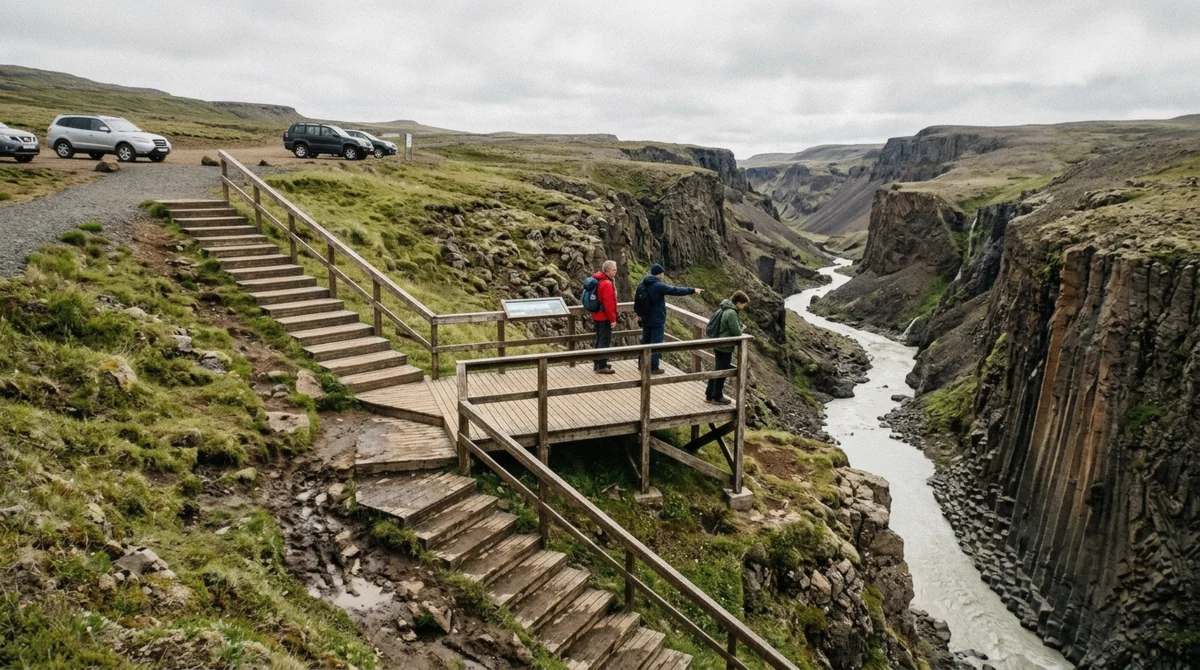
The farm Grund on Jökuldalsvegur has the developed car park: room for coaches, covered seating, water, and toilets that charge. From there the walk is about 0.6 km with 50 m of descent, and the descent is a metal staircase of 245 steps down to a viewing platform above the gorge.
What you get is a view down onto the columns and the river from above, taken in fifteen minutes. What you do not get is the whole canyon: the main section curves away behind the bend and stays out of sight. New platforms and stairs went in for the 2025 season, so the west side is better than the older guidebooks describe, but it remains a look rather than an immersion.
Every coach trip from the cruise pier stops here. On a wet day, with a mixed-ability group or an hour to spare, it is the right choice.
East side: the walk in from Klaustursel
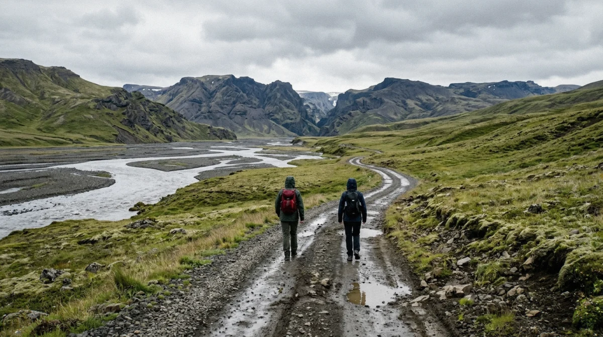
Cross to the far bank and the visit changes character. The track starts near the farm Klaustursel and runs along the river to the gorge: about 5.7 km round trip, 130 m of climbing spread over two gentle rises, an hour of walking at a normal pace, on a gravel road wide enough for a vehicle.
There are two car parks. The first is at the start of the rough section; the second sits about ten minutes further along a bumpy, potholed track that most 2WD cars manage in dry weather, and taking it saves roughly two and a half kilometres of walking. After heavy rain, leave the car at the first one.
Past the second car park the route passes Stuðlafoss, a waterfall framed by its own basalt columns and worth the stop on its own. The last stretch drops to the river, where the path turns muddy and chains and ropes are fixed to the rock to help you down.
This is where the photographs come from. Columns curve overhead on both banks, the water runs fast and pale below, and the scale only registers when somebody in your group stands at the bottom of a wall.
What it costs
The canyon itself is free. The charges are for parking and plumbing.
| What | Cost | How you pay |
|---|---|---|
| East-side car park | 1,000 ISK per vehicle | Parka app, QR code on site |
| West-side car park at Grund | Free to park | No charge |
| Toilets at Grund | Small fee | Card accepted |
| Entry to the canyon | Nothing | It is not a gated attraction |
| Guided trip from the pier | $227 to $407 per person | Booked ahead, free cancellation 24h |
Facilities, or the lack of them
Grund has toilets, covered seating and a water refill point. The east side has nothing: no toilet, no shelter, no water, no signal worth relying on. Whatever you need for two hours you carry in, and you carry the rubbish out.
There is no café at either car park and no shop between the Ring Road and the canyon. The nearest supplies are in Egilsstaðir.
Staying safe on the rock
Two things catch people out. The first is water: it drips constantly off the columns onto the path near the descent, and wet basalt with a film of silt on it is genuinely slippery. Boots with grip matter more here than the flat profile of the walk suggests.
The second is the river. The Jökulsá á Dal still carries around 95 m³/s past the columns, cold and fast, and the rocks people scramble onto for photographs sit right at the edge of it. Nobody is going to fish you out. Keep off the wet rock at the waterline and take the photograph from a metre back.
When the water is turquoise
This is the question that decides your trip, and the answer is seasonal rather than meteorological. Clear reservoir water and low sediment give the blue-green colour from roughly March to July. As summer melt increases, the glacial load rises and the river turns grey-brown, sometimes as early as late July and reliably by late August into September.
So the season for the canyon and the season for the colour are not the same thing. June and July give you both. September gives you an accessible canyon with a grey river, which is still a striking place and not what you saw on Instagram.
- March to July: the turquoise window, though the tracks may still hold snow early on
- June to October: the practical visiting season for both sides
- Late July onwards: colour fades as meltwater rises
- November to March: ice on the descent, short daylight, and no guided trips from the coast
What else is in Jökuldalur
The valley you drive up to reach the canyon is worth more than the twenty minutes most itineraries give it. Rjúkandi falls down a mossy cliff a short walk from the road and appears on most guided trips as a photo stop. Klaustursel, the farm at the east-side trailhead, has kept reindeer and other animals and is part of why the herd is associated with this valley at all.
Jökuldalur is also one of the emptiest inhabited valleys in Iceland. The farms are far apart, the river cuts deep, and outside the canyon car parks you can drive for stretches without meeting anyone. That emptiness is half the reason the place felt like a discovery in 2016 rather than a new viewing platform.
Other columnar basalt in Iceland, and why this one is different
Iceland is not short of basalt columns. Svartifoss in Skaftafell drops over a fan of them and gave Reykjavík's Hallgrímskirkja its shape. Reynisfjara on the south coast has the stacked wall behind the black sand that every south-coast bus stops at. Hljóðaklettar in the north has whole echoing chambers of them.
What Stuðlagil has that none of those do is a canyon of columns with a river running through the middle of it. At Svartifoss you look at a cliff; here you stand between two walls of them with water underneath. The scale is the point, and it is the reason a place that has been findable for less than twenty years now appears on more Iceland itineraries than sites people have visited for a century.
Staying nearby
Nobody sleeps at the canyon. Egilsstaðir, an hour away, is the practical base for the east: it has the supermarkets, the fuel, the airport and most of the beds, and it puts you within reach of Vök Baths, Hengifoss and Hallormsstaður as well as the canyon.
A handful of farms and guesthouses in Jökuldalur itself take guests in summer, which is the option for anyone who wants to be at the east-side car park at seven in the morning before the first coach. Book those early; the valley has very few rooms in it.
Off a cruise ship the question does not arise. You have the hours your ship gives you and the drive takes three of them.
Farm land, drones and litter
Both sides of the canyon sit on private farmland. The car parks, the paths and the staircase were built and are maintained by the farming families who own it, which is what the 1,000 ISK parking fee pays for.
That carries some obligations. Stay on the marked tracks rather than cutting across grazing land, close gates behind you, and take everything out with you, because there is no bin on the east side and no one is paid to empty one. Drones need the landowner's permission and are unwelcome over the colony of photographers on a busy afternoon in any case. None of this is signposted at length. It is assumed.
- Hiking shoes with grip, for wet basalt rather than for distance
- A waterproof jacket and trousers; the valley funnels rain and there is no shelter
- Water and food for the whole visit, since nothing is sold at either car park
- A card for the toilets at Grund and the Parka parking app
- A camera with a polariser if you have one, for the glare on the water
- A bag for your rubbish, which leaves with you
Winter, and why almost nobody goes
The canyon does not close, because there is nothing to close. What happens is that the metal staircase on the west side ices, the east-side track turns to frozen ruts, and daylight shrinks to four or five usable hours in December.
People who do make it in February get the clearest water of the year, snow on the columns and the place to themselves, and they get it in a 4x4 with proper tyres and a weather forecast open on the phone. Northern lights over the gorge are a real photograph and a genuinely bad idea to attempt alone on ice in the dark.
From Seyðisfjörður the question is settled for you: the cruise season ends in September and the Fjarðarheiði pass above the town shuts in storms through the winter.
Photography
The east side, without much competition. The gorge faces in a way that gives even, soft light under cloud, which is what you usually get, and hard midday sun tends to blow out the water while leaving the columns in shadow.
A polariser helps with the surface glare on the river. A wide lens handles the walls, but the shot most people miss is the tight one: three or four columns and the water, without the sky in it. And put a person in frame somewhere, because nothing else in the picture gives the scale away.
Combining it with something else
Most trips pair the canyon with one of three things, and the pairing is what fills a day out of Seyðisfjörður.
- Rjúkandi waterfall, in the Jökuldalur valley on the way, a 20-minute stop that costs nothing
- Vök Baths, floating geothermal pools 32 minutes from the pier, included on two guided trips
- The Reindeer Park, where rescued calves from Iceland's only wild herd live, on one trip
- Gufufoss, 27 m and four minutes from the pier, which nearly every canyon trip stops at on the way back
How busy it gets, and how to miss it
Ten years ago this was a place two people knew about. In July the west-side car park now holds coaches and the platform has a queue for the good corner of the railing.
The pattern is predictable, because it is set by where everyone sleeps. Coaches out of Egilsstaðir and the cruise trips from Seyðisfjörður arrive between eleven and three, and both sides are busiest in that window. Before nine and after six, the east-side track is close to empty even in high summer.
On a port call you have no choice: your coach lands in the middle of the day with all the others, and an hour at the platform is still an hour at the platform. Driving yourself, the difference between arriving at eight and arriving at noon is the difference between a gorge and a viewpoint with a crowd on it.
Stuðlagil Month by Month
What the canyon is actually like when you arrive, rather than what the photographs promise.
- Jan–MarIced inThe descent freezes and daylight is short. No guided trips run from the coast. The water is at its clearest and almost nobody sees it.
- AprilThawTracks soften and turn muddy. The turquoise is in and the crowds are not. A 4x4 helps on the east-side road.
- MayOpening upBoth sides walkable, colour strong, first coaches from Egilsstaðir. Cruise season starts at the coast.
- JunePeak, and the best of itLong light, dry tracks, turquoise water. The busiest hours are 11am to 3pm when the tour coaches land.
- JulyPeak, colour fadingWarmest and driest month. Meltwater is rising, so the river may already be losing its blue by month end.
- AugustGrey waterAccess at its easiest, colour usually gone as the reservoir spills. Puffins leave the coast mid-month.
- SeptemberQuiet and emptyFewer people, autumn colour on the valley, grey river. Last reliable month for the east-side walk.
- OctClosingEnd of the practical season. Weather turns fast and the pass above Seyðisfjörður starts closing in storms.
- Nov–DecShut in practiceSnow, ice and four hours of usable light. The canyon is still there; getting to it safely is another matter.
The season for visiting and the season for the turquoise are not the same. June and July give you both.
Where Stuðlagil Is
Off road 923 in the Jökuldalur valley, about an hour from Egilsstaðir and 90 minutes from the Seyðisfjörður pier.
Stuðlagil Canyon Questions
How long is the hike to Stuðlagil Canyon?
About 5.7 km round trip from the second east-side car park, with 130 m of climbing and roughly an hour of walking, plus however long you spend in the gorge. From the first car park it is around two and a half kilometres longer. The west side is not a hike at all: 0.6 km and 245 steps down to a platform, done in fifteen minutes.
Which side of Stuðlagil Canyon is best?
The east side, if you can walk 5.7 km. It puts you at river level with the columns above you, which is the view that made the place famous. The west side at Grund shows you the gorge from a platform above and leaves the main section hidden behind the bend, but it takes fifteen minutes and has toilets and covered seating.
How do you pronounce Stuðlagil Canyon Iceland?
Roughly STUTH-la-gil. The ð sounds like the th in that, the g is soft, and the stress falls on the first syllable. The name is stuðla, columns, and gil, gorge, so it means the column gorge.
Can you get to Stuðlagil Canyon without 4x4?
Yes. Road 923 and the west-side car park at Grund are fine for any car. The east-side track to the second car park is rough and potholed but passable in a 2WD in dry weather; after heavy rain, park at the first lot and walk the extra distance. Only the deep-winter approach genuinely needs a 4x4.
Is Stuðlagil Canyon worth it?
If the river is turquoise and you take the east side, few places in Iceland compare. If you arrive in September on a coach that stops for an hour at the west platform, you get a good view of a grey river. Both are worth doing; the difference between them is larger than most people expect, which is the reason this page separates them.
How much does it cost to visit?
The canyon is free. East-side parking is 1,000 ISK per vehicle through the Parka app, the toilets at Grund charge a small fee, and there is nothing else to pay. From the cruise pier a guided trip costs $227 to $407 per person because you are buying the 180 minutes of driving, not access.
Can you visit Stuðlagil in winter?
You can reach the west platform in good conditions, but the steps and the east-side descent ice over and daylight is short. No operator runs a guided trip from Seyðisfjörður in winter, because the cruise season ends in September and the Fjarðarheiði pass above the town closes in storms.
How do I get there from a cruise ship?
By guided coach or minibus. There is no rental desk in Seyðisfjörður, no bus service up the valley, and 98.8 km each way. Six of the trips leaving the pier go to the canyon: three to the west-side platforms from $227, two that walk the east side from $369, and a private jeep at $2,290 for up to four people.
Can you swim in the river at Stuðlagil?
No, and nobody should try. The Jökulsá á Dal still carries around 95 m³/s of glacial meltwater past the columns, cold and fast, with no easy way out once the current takes hold. People do scramble onto the wet rock at the waterline for photographs, and that is the single most dangerous thing anyone does here.
Is there a bridge between the two sides?
Not yet. A footbridge has been planned since 2019 and has not been built, so the two sides are separate visits reached by separate roads, seven minutes apart by car. If you want both in one day, do the east-side walk first and stop at the Grund platform on the way out.
Can you camp at the canyon?
Not at either car park. Both sides are private farmland with day parking only, and the nearest campsites are down the valley and around Egilsstaðir. Sleeping in a vehicle outside a marked campsite is illegal across Iceland, and here it would also block a working farm's parking area.
How long a detour is it from the Ring Road?
Road 923 leaves Route 1 in the Jökuldalur valley and the west-side car park is about 20 km along it, so the detour costs roughly 40 minutes of driving plus your time at the canyon. For the west platform that means an hour and a half out of a driving day. For the east-side walk, allow three hours.
Do I need to book anything in advance?
Not to visit. There is no ticket, no time slot and no gate; you park, you pay for the parking on the east side, and you walk in. The only thing that needs booking is a guided trip, and those do sell out on days when two ships are in port at Seyðisfjörður.
Is the canyon lit for photographs early or late?
Neither side gets direct sun down at the water for much of the day, because the walls are high and the gorge is narrow. Overcast light is the friend here: it evens out the columns and stops the river blowing out. If you want warm light on the rock above the waterline, the late evening in June and July is the only reliable window, and it is also the emptiest time on the east-side track.